Our Rohe
Territorial boundaries are referred to as ‘rohe’ in te reo Māori, and are generally defined by prominent geographical features, such as maunga (mountains), awa (rivers), moana (seas), and roto (lakes).
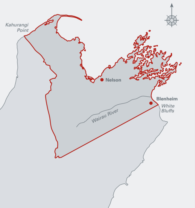
The rohe of Ngāti Koata includes the whenua (land) and moana (sea) contained within the tuku of Tūtepourangi. From Anatoto at the mouth of the Pelorus Estuary and including the Sounds and around the coast from Kaiaua (Croisilles Harbour) to Cape Soucis, Whangamoa, Whakapuaka, Whakatū, Waimea, Motueka, and on to Te Matau (Separation Point). Ngāti Kōata oral tradition says that the tuku started at Anatoto at the mouth of the Pelorus Sound and included Kurupongi, Nga Kiore, Takapourewa and extended to Onetahua (Farewell Spit). Subsequent occupations also included the Pelorus Sounds.
Pepeha
The rohe of Ngāti Koata is encapsulated in the following pepeha.
Mai i te Awa Te Hoiere
Ki Kurupongi ki Ngā Kiore ki Takapourewa
Whiti atu ki Te Hiku o Te Matau
Koata Taonga
Koata Mana
Koatatanga
NEXT: Our Organisation
Information about our organisation its trustees and their governance roles, our mission, vision and how we are structured.